
Building GIS with a Purpose:
Nature Ground.
As the 2026 El Niño season brings severe storm risks, proactive planning is your strongest defense. We combine live NOAA weather feeds, 72-hour predictive flood modeling, and custom ESRI Dashboards with NGICP-certified green infrastructure to protect critical assets and enhance urban ecosystem services.
Captured with high-res GPS to convert legacy maps into live GIS service layers.
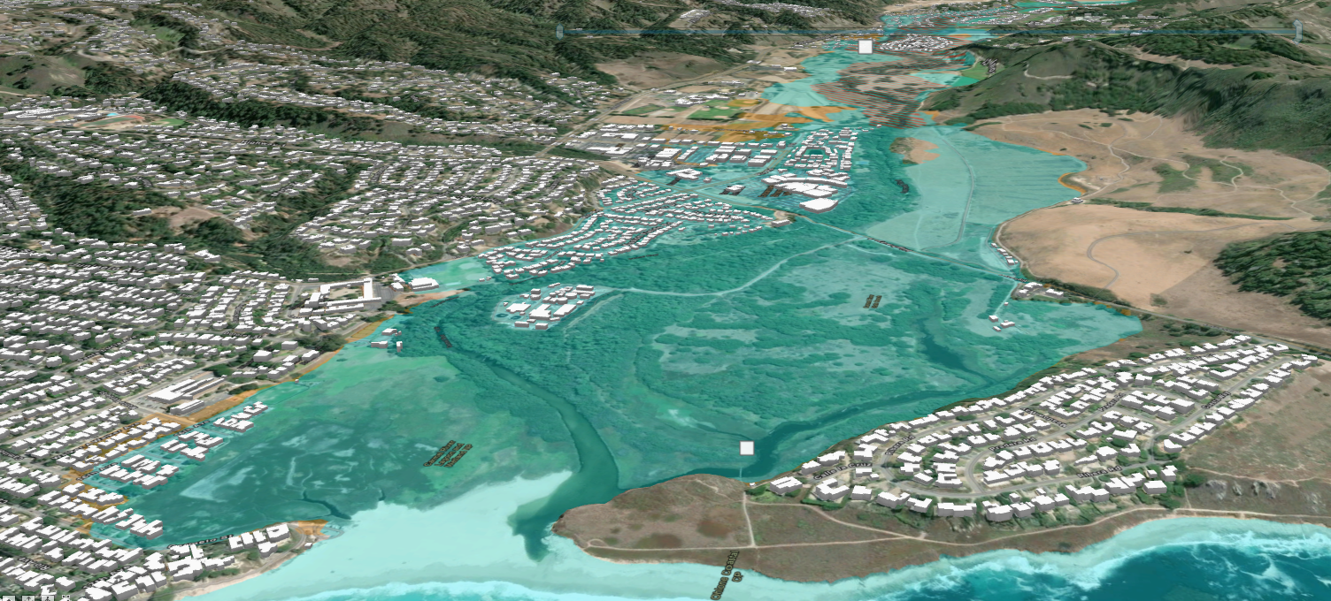
Mapped with invert elevations, as-built plans, and FEMA flood modeling.
From public mobile trail apps to municipal geometric utility networks.
Trusted by California water districts, cities, and fire protection agencies.
The Impervious Cover Threshold & Natural Water Cycle
Stream quality and watershed health diminish when urban impervious cover exceeds 10%, and become severely degraded beyond 25% (Center for Watershed Protection). Click below to compare hydrologic pathways.
Pre-Developed Natural Hydrologic Balance
In a natural watershed, tree canopies intercept rainfall, plants release moisture through transpiration (40-50%), and uncompacted native topsoil allows deep infiltration into the unsaturated zone and underlying aquifer ("groundwater warehouse"). Overland surface runoff is less than 1%, maintaining cool baseflows in streams year-round.
Why Municipalities Are Shifting From Grey to Green
Traditional grey infrastructure collects and conveys polluted stormwater through costly pipes and vaults without reducing volume. Green infrastructure mimics nature where rain falls.
Traditional Grey Infrastructure
Pipes, Curbs, Gutters, Detention Vaults & CSOs- Poor Volume Reduction: Quickly pipes peak flows into streams, causing severe channel erosion and habitat loss.
- Combined Sewer Overflows (CSOs): Heavy rains overwhelm combined pipes, discharging untreated sewage and metals into waterways.
- Rising Capital Costs: Aging concrete tunnels and centralized treatment expansions require massive bond debt.
GID Green Infrastructure (Nature Ground)
Bioretention, Permeable Pavements, Wetlands & Roofs- 70%-90% TSS & Metal Removal: Engineered soils, compost, and native roots filter suspended solids, copper, and zinc at the source.
- Urban Ecosystem Services: Mitigates urban heat islands, sequesters carbon, creates pollinator habitat, and boosts property values.
- Grant-Eligible & Stormwater Resilient: Qualifies for state/federal grant funding and reduces municipal strain during El Niño storms.
About Green Infrastructure Design (GID)
For over two decades, the GID #GreenTeam has pioneered the convergence of sub-meter GPS field audits, enterprise ESRI GIS architecture, Custom Cartography, and NGICP Certification.

ESRI GIS • NGICP Certified • Microsoft Certified Trainer

Leadership, Cloud Architecture & Training Team

Alexis Schweisinger
Owner, Green Infrastructure DesignPrimary contact for municipal leadership and strategic partnerships. Leads Green Infrastructure project development, grant acquisition, and large-scale habitat restoration initiatives.

Ashley Asta
Sr. Project Manager, Training Specialist, Creative DirectorBridges complex geospatial engineering with creative direction, workforce training, and client communication - translating live GIS intelligence into green infrastructure and public apps.
John Schweisinger, NGICP
GIS Advisor & NGICP TrainerCertified NGICP Trainer with over 20 years of project management expertise in sub-meter GPS Field Audits, Geometric Network Design, Needs Assessments (NA), and master Cartography.

Ken Richardson
GIS Cloud Solutions ArchitectArchitects scalable cloud GIS infrastructures, live ESRI Enterprise deployments, automated cloud databases, and high-availability spatial service layers for municipal agencies.
20+ Year Milestone Timeline
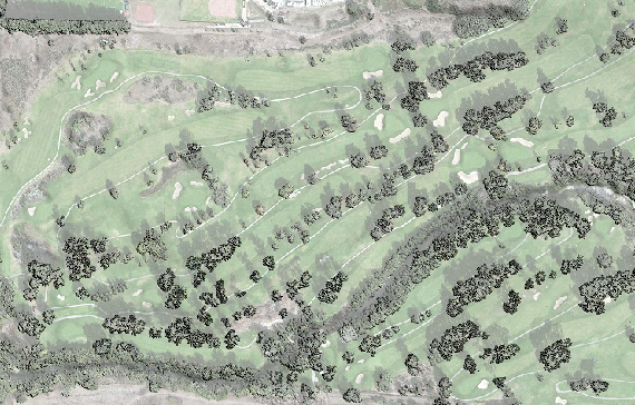
Incorporated in California on March 14, 2002, Green Infrastructure Design pioneered high-precision RTK GPS terrain mapping for Bayonet Black Horse Golf Course and digitized complex reclaimed water irrigation networks across coastal golf courses and community service districts.
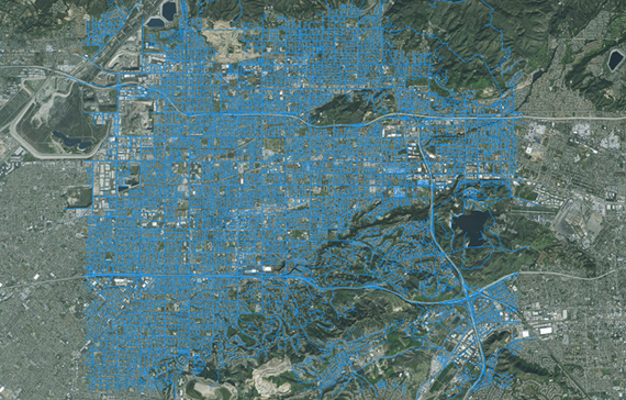
Expanded into statewide municipal water utilities, executing high-precision GPS field audits for California American Water, Global Water, Irvine Ranch Water District (100,000+ service meters), and the City of Torrance (28,000 AMI smart meter replacements).
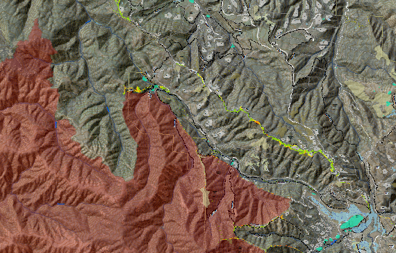
Engineered pre-fire Web GIS Hubs for Big Sur Fire and Woodside Fire Protection District, created the Monterey County Fire Fuels Mapping Project (FFMP), mapped post-burn erosion treatments for the Soberanes and Carmel fires, and modeled FEMA 100-year floodplains for CAWD.
Delivering 72-hour predictive flood modeling, live NOAA radar and stream gauge ESRI Dashboards, 3D Drone LiDAR plant digital twins (LOD 300), and NGICP-certified Nature Ground green infrastructure across California.
Nature Ground & Green Infrastructure Practices
"Nature Ground" refers to the overlooked interstitial urban spaces - sidewalks, right-of-ways, easements, and parking margins - that we transform into high-performing islands of natural infiltration, stormwater capture, and habitat.
Living Bioretention & Rain Gardens
Engineered soil media and native root systems filter 70-90% of Total Suspended Solids (TSS) and heavy metals where rain falls.
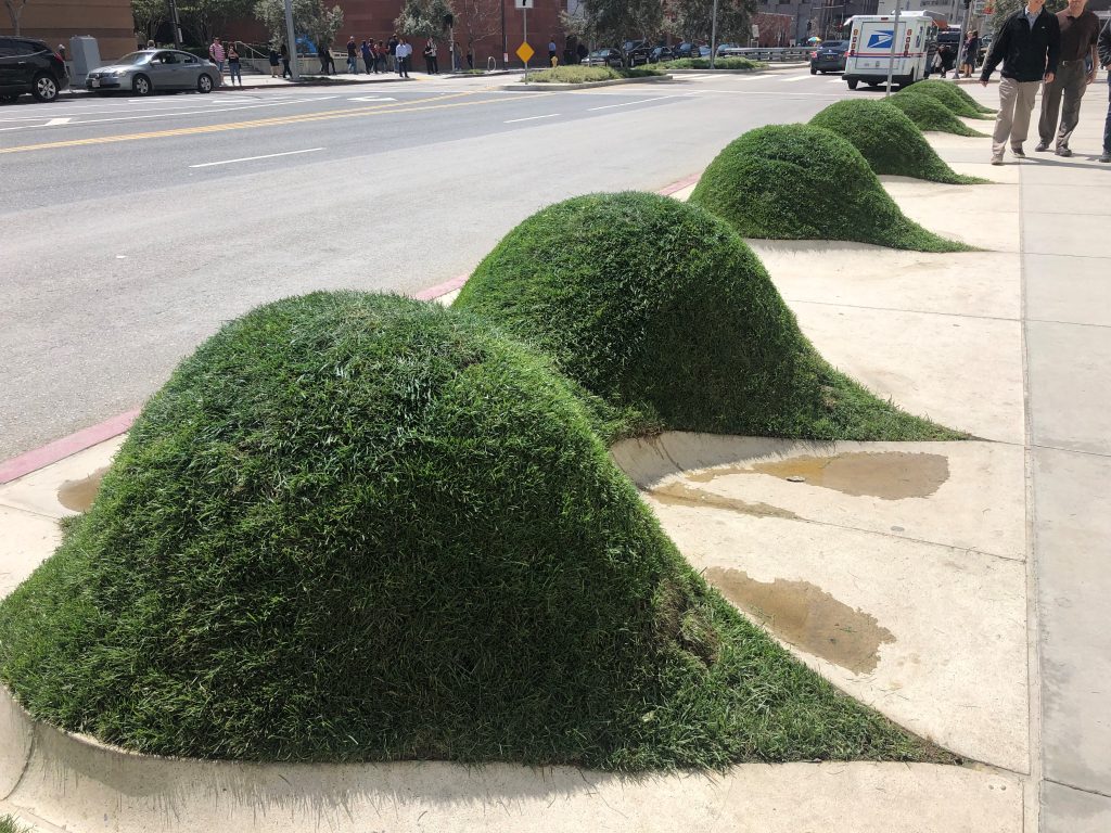
Green Streets & Curb Bulb-Outs
Converting impervious street margins into traffic-calming vegetated curb extensions and subsurface tree trenches.
Net-Zero Watershed Concepts
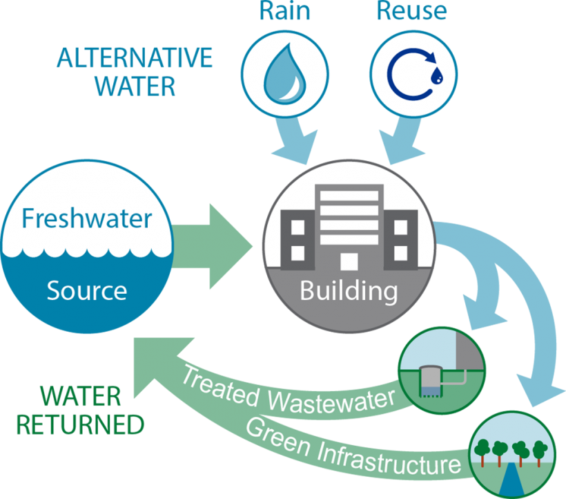
Combining rainwater harvesting cisterns, permeable pavements, and dry wells to recharge underlying groundwater aquifers.
Nature Ground Stormwater Capture & TSS Estimator
Complete Urban Green Infrastructure Systems
Explore how we site, engineer, construct, and inspect all six primary green infrastructure systems to mimic the natural water cycle and protect receiving waters.
Bioretention, Curb Bulb-Outs & Tree Trenches
Includes rain gardens (100-200 sq ft), linear bioswales (3H:1V side slopes with check dams), vegetated curb extensions for traffic calming, concrete planter boxes, and subsurface structural soil tree trenches (Silva Cells / 1-3 ft³ soil per 1 ft² crown).
Permeable Surfaces
Porous Asphalt (polymer-modified emulsion over choker course), Pervious Concrete (rigid Portland cement mix compacted with rotating Bunyan screed), Interlocking Pavers (No. 8 joint stone, No. 57 bedding, No. 2 base), and Plastic Grids.
Rainwater Harvesting: Barrels & Cisterns
Captures roof runoff via daisy-chained residential rain barrels or commercial above/below-ground cisterns. Includes pre-treatment leaf screens, mosquito/vermin screens, backflow preventers, and UV/membrane filtration.
Extensive/Intensive Green & Blue Roofs
Extensive Green Roofs (<6" lightweight media with sedums) and Intensive Roofs (≥6" media for shrubs/trees) layered over root barriers and EPDM/TPO waterproofing membranes with electronic leak detection. Blue Roofs use outlet check-dam weirs.
Dry Wells & Infiltration Trenches
Excavated vertical wells or linear trenches lined with non-woven geotextile and filled with uniformly graded washed rock. Incorporates pretreatment settling sumps (cleaned before 1/3 full) and observation wells.
Constructed Stormwater Wetlands
Engineered upland basins with sediment forebays (dredged at 50% capacity), weirs, and multi-depth zones supporting submerged, floating, floating-leaved, and emergent plants plus pollutant-degrading microbes.
Our 5-Step Operational Methodology
GID bridges physical field operations and digital office management through a structured five-step process - transforming fragmented paper records into live GIS service layers and thriving green infrastructure.
Click Any Step Below to Inspect Deliverables, Hardware & Imagery
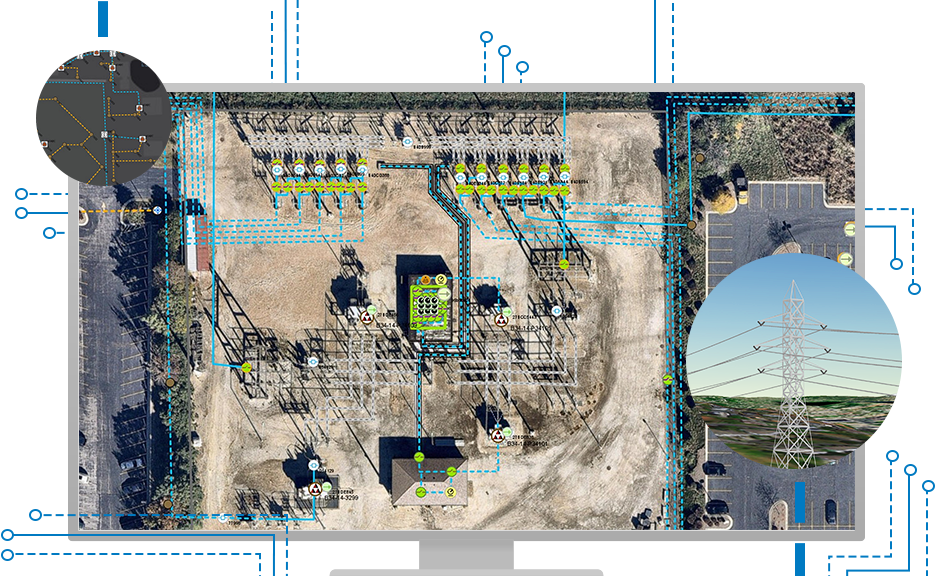
Most municipalities and special districts rely on fragmented legacy records. We aggregate historical CAD drawings, paper as-built plans, assessor parcel maps, and field notes - cleaning geometries, resolving topological errors, and publishing standardized ESRI ArcGIS Enterprise and ArcGIS Online (AGOL) REST feature layers.
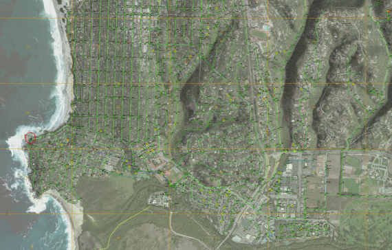
Our #GreenTeam deploys into the field equipped with Trimble Catalyst DA2 GNSS receivers, Vivax vLoc3 RTK-Pro underground utility wands, and UAV drones. We physically ground-truth water valves, fire hydrants, manholes, meters, and stormwater catch basins while capturing near-infrared (NIR) aerial imagery and 3D LiDAR elevation topographies.
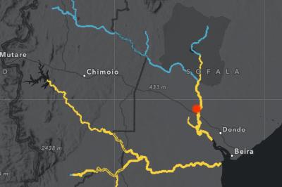
Verified spatial data streams directly into custom ESRI Dashboards, Experience Builder apps, and Web GIS Hubs. By integrating live NOAA weather radar, active stream gauges, real-time traffic updates, and 72-hour predictive flood models, we eliminate the delay between field observations and executive decision-making.
Using spatial suitability models, we pinpoint high-return "Nature Ground" locations across rights-of-way, parking margins, and burn scars. We collaborate with landscape architects, civil engineers, and NGICP-certified crews to construct bioretention cells, bioswales, permeable pavements, rainwater cisterns, and stormwater wetlands.
Green infrastructure is a living system requiring structured lifecycle stewardship. We ensure multi-decade performance through engineer-stamped Record Drawings ("As-Builts"), site-specific O&M manuals, standardized photo documentation logs, Pilot Infiltration Testing (PIT), ASTM C1701 surface monitoring, and automated CMMS work-order routing.
GPS Field Audits & Data Remediation
Utilizing Trimble Catalyst DA2 GNSS systems and Vivax vLoc3 RTK-Pro locators integrated with ArcGIS Field Maps, our crews physically verify every valve, hydrant, manhole, meter, and stormwater catch basin so what is in the ground matches your GIS basemap.
CAD-to-GIS Geodatabase Conversion
We convert paper as-builts and fragmented CAD files into topological ArcGIS Enterprise geometric networks, tying in assessor parcel data, invert elevations, and CCTV inspection records.
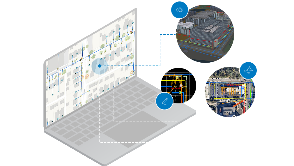
Disconnected Offline VTPK Basemaps
We package custom Vector Tile Packages (VTPKs) so utility and fire crews retain high-speed, high-resolution basemaps even in deep canyons or during power and cellular blackouts.
Trimble Catalyst DA2 GNSS
Sub-centimeter RTK horizontal and vertical Z-elevation accuracy for water meters, valves, hydrants, and manholes.
Vivax vLoc3 RTK-Pro Locators
Simultaneous underground utility line electromagnetic tracing and real-time RTK coordinate logging into ArcGIS Field Maps.
CMMS & Parcel Attribute Tie-Ins
Cross-referencing APNs, street addresses, pipe diameters, material types, and condition scores for automated work orders.
Live GIS Layers
As ESRI Business Partners, we engineer complete municipal GIS basemaps powered by high-resolution live service layers - integrating live NOAA radar, active stream gauges, real-time traffic, sub-meter GPS field edits, and near-infrared drone orthomosaics.
Toggle Live REST Feature Service Layers & Basemap Modes
Sub-centimeter RTK GNSS coordinates, invert elevations, flow arrows & CCTV links.
Tracks PIT infiltration rates, 70-90% TSS capture, and O&M inspection schedules.
Pre-fire WUI structure assessments and post-burn slope stabilization treatments.
Real-time hydrograph stages overlaid with critical treatment plant infrastructure.
1. ArcGIS Enterprise & Cloud Architecture
Led by Cloud Solutions Architect Ken Richardson, we deploy high-availability ArcGIS Enterprise and ArcGIS Online (AGOL) environments with Role-Based Access Control (RBAC), automated cloud backups, and secure REST endpoints.
2. Geometric & Utility Network Modeling
We migrate fragmented CAD drawings into topological utility networks for water, reclaimed water, wastewater, and stormwater - enabling upstream/downstream trace analytics, valve isolation, and capacity modeling.
3. Custom Web GIS Hubs & Experience Builder
We build intuitive ESRI Dashboards and Web Experience apps that collapse the spatial-temporal divide between field crews and executive decision-makers.
Predictive GIS, Live Emergency Dashboards & Post-Fire / Storm GI
As we face the severe storm risks of the 2026 El Niño Season, organizations need more than static maps to protect their communities - they need real-time, data-driven intelligence paired with engineered Green Infrastructure to mitigate flood and debris-flow vulnerabilities.
72-Hour Predictive Modeling & Live NOAA Command Dashboards
Our firm specializes in integrating live NOAA weather data and advanced spatial layers into custom ESRI Dashboards and Experience Builder applications tailored for Emergency Management. By incorporating live stream gauges, real-time traffic updates, and 72-hour prediction models, we empower organizations to monitor storms as they happen and execute predictive mapping to plan ahead of the surge.
These dynamic tools allow you to visualize active flooding zones during a storm and proactively protect critical infrastructure and assets located within FEMA floodplains.
Active Stream Gauges
Real-time hydrograph stage & surge alerts
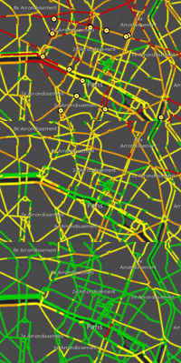 Live Traffic & Closures
Emergency routing & road hazard tracking
El Niño Carmel Model
FEMA floodplain & asset protection overlay
Burn Scar Debris Risk
Post-fire hydrophobic slope runoff modeling
Live Traffic & Closures
Emergency routing & road hazard tracking
El Niño Carmel Model
FEMA floodplain & asset protection overlay
Burn Scar Debris Risk
Post-fire hydrophobic slope runoff modeling
Custom ESRI Dashboards
Centralized, live-updating emergency response hubs for command centers & public outreach.
Real-Time NOAA & Data
Layering live weather radar, active stream gauges, and real-time traffic conditions.
72-Hour Predictive Models
Advanced forecasting and hydraulic GIS modeling to anticipate flood paths ahead of the surge.
FEMA Floodplain Overlays
Overlaying critical infrastructure against FEMA flood zones to prioritize asset protection.
Live Hazard Visualization
Real-time tracking of flooded areas, road closures, and storm cell movements for routing.
Why Post-Fire & Storm Slopes Fail Without Green Infrastructure
When fire or construction strips stabilizing vegetation and mulch, bare soil is exposed to sheet flow. By shortening slope lengths with terraced bioretention, compost wattles, and rip-rap check dams, GID neutralizes destructive debris flows before they overwhelm municipal storm drains.
Post-Fire Burn Scar Mapping & 4-Tier Restoration
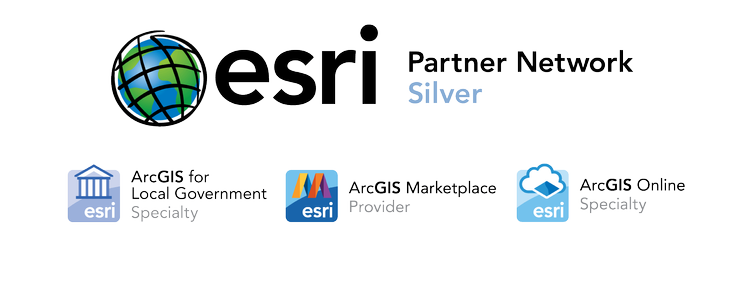
Following the Soberanes and Carmel fires, GID deployed sub-meter GPS and drones to map fire lines, slope gradients, and soil severity - engineering 4 distinct restoration strategies using contour surface roughening, wattles, and native hydroseeding.
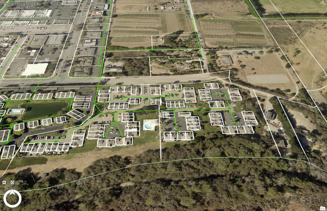
Post-Storm Floodplain & Coastal Resilience GI
Using FEMA 100-Year Floodplain GIS models (deployed for CAWD), we site constructed stormwater wetlands, rip-rap energy dissipators, bioswale check dams, and dry wells to absorb atmospheric river storm pulses.
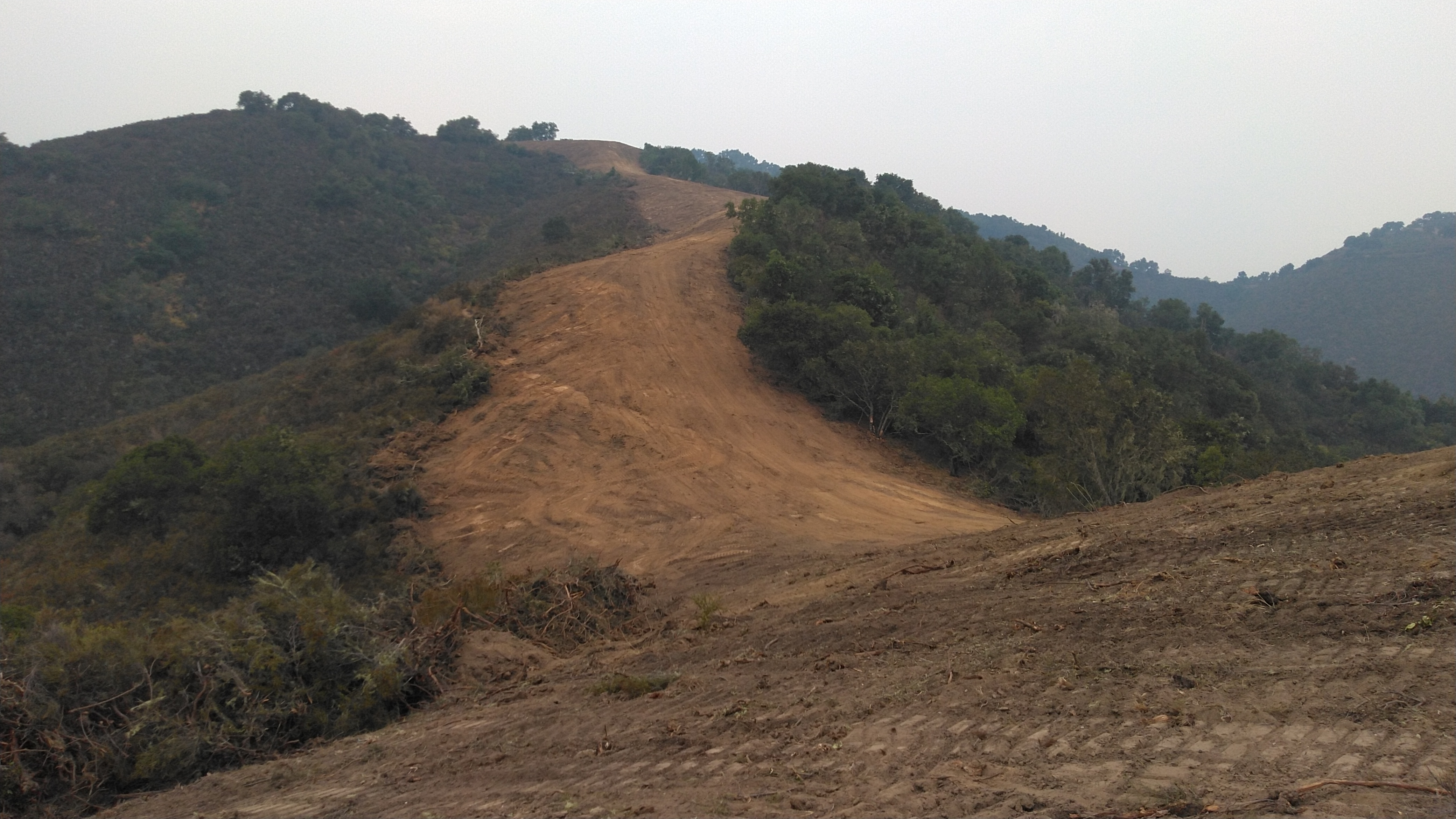
Pre-Fire WUI Command Hubs & Fuel Break GIS
Engineered for Big Sur Fire, Woodside Fire, and the Monterey County Fire Fuels Mapping Project (FFMP), we build live WUI pre-plan hubs tracking defensible space, hydrant flow capacities, shaded fuel breaks, and emergency evacuation routes.
Professional Cartography & Engineering Basemap Production
GID delivers authoritative cartography - ranging from engineering plan-profile-section sheets and watershed contour maps to public mobile trail apps.
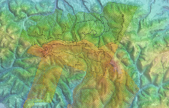
Watershed & Topographic Contour Maps
High-resolution grading and watershed maps delineating equal-elevation contour lines, ridge boundaries (where flow divides), valley collection lines, and contributing drainage areas.
Plan, Profile, Cross-Section & Record Drawings
Complete construction document cartography: scaled Plan Views (e.g., 1" = 20 ft), Longitudinal Profiles, Cross-Sections, Planting Palettes, and engineer-stamped Record ("As-Built") Drawings.
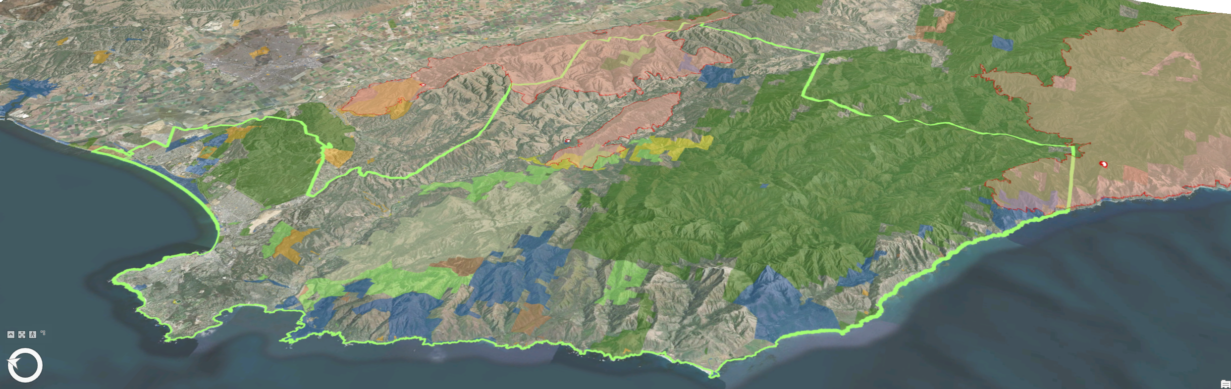
Public Trail Apps, Avenza PDFs & VTPK Basemaps
Interactive storytelling cartography such as MPRPD's "LGO on the GO!" Visitor Education Guide, georeferenced Avenza PDF maps for Mission Trails Nature Preserve, and offline Vector Tile Packages.
APWA Uniform Utility Color Code & Survey Layout Symbology
Drone LiDAR & 3D Plant Digital Twins
Moving beyond flat 2D site plans, GID deploys unmanned aerial vehicles (UAVs) and terrestrial LiDAR to construct high-fidelity 3D spatial replicas at Level of Detail (LOD) 300. We penetrate vegetation canopies to generate bare-earth DEMs, watershed ridge/valley flow lines, and 3D multipatch models integrated with Autodesk Tandem and ArcGIS GeoBIM.
Bare-Earth DEM & Canopy Penetration
High-density LiDAR point clouds strip away dense coastal brush and forest canopies to reveal micro-topography, fault lines, and exact stormwater drainage pathways.
LOD 300 Treatment Plant Digital Twins
We model complex wastewater and water treatment facilities in 3D, linking valves, pumps, and clarifier tanks directly to CMMS maintenance records via Autodesk Tandem & GeoBIM.
Near-Infrared (NIR) Vegetation Health
Multispectral drone flights quantify plant vigor across bioretention corridors, wetland restoration zones, and WUI fuel breaks.
Grant Writing & Capital Acquisition
GID does not merely design projects; we actively fund them. Our #GreenTeam navigates federal, state water board, and wildfire resilience grants to subsidize your GIS basemaps and green infrastructure retrofits.
Carmel River Steelhead Association (CRSA)
Secured grant funding to build a Web GIS Portal informing fisheries management, river habitat restoration, and steelhead trout conservation across the Carmel River watershed.
Fire Safe Council of Monterey County
Acquired essential grant funding directly financing local fire adaptation, community fuel-break mapping, and WUI infrastructure modernization.
Turnkey Grant Application & Spatial Justification
Grant agencies require quantifiable proof of pollutant reduction, disadvantaged community benefit, and flood mitigation. GID pairs our grant writers directly with our GIS analysts to produce authoritative watershed maps, TSS capture models, and benefit-cost graphics that win competitive state and federal awards.
Workforce Capacity Building & Certification
Led by NGICP Trainer John Schweisinger and Training Specialist Ashley Asta, we empower municipal crews, engineers, and command staff with hands-on training in NGICP standards, progressive ESRI ArcGIS tracks (New, Learn, Improve), and full-scale Microsoft 365 implementation.
NGICP Certification
Comprehensive curriculum preparing constructors, inspectors, and maintainers for the National Green Infrastructure Certification Program exam.
GIS Training
Hands-on training built directly inside your organization's live GIS environment using real operational projects to help your team learn and get actual work done simultaneously.
Microsoft 365
We don't just make maps - we transition agencies to an all-Microsoft ecosystem (Teams, SharePoint, OneDrive, Excel, Outlook, PowerPoint & Government Licensing) with tailored onsite shift schedules.
ESRI Enterprise, Desktop & Mobile GIS Training
Rather than teaching with generic textbook sample data, we build and conduct our training directly inside your organization's live GIS environment using hands-on training projects. Your staff learns best-practice spatial workflows while getting real agency work done at the same time.
Built Inside Your Client Environment - Learn & Get Real Work Done
Traditional software classes use unfamiliar sample cities that staff forget as soon as they return to their desks. GID configures hands-on training projects directly within your own ArcGIS Online (AGOL), ArcGIS Enterprise, and ArcGIS Pro environment—using your actual parcels, utility networks, field forms, and basemaps.
Staff gain confidence navigating their exact daily tools, permissions, and mobile field apps.
By the end of training, your team has built live dashboards, cleaned geodatabases, or deployed field inspection forms ready for production.
Structured Learning Tracks: New • Learn • Improve
Select a competency level below to see how we tailor our hands-on ESRI instruction to match each staff member's starting point.
Foundational Spatial Literacy & Navigation
Designed for staff brand new to GIS, field crews, and administrative personnel transitioning from paper maps or spreadsheets into a digital spatial environment.
- GIS Fundamentals: Understanding spatial layers, feature classes, attributes, coordinate systems, and symbology.
- ArcGIS Online & Portal Basics: Navigating your agency's Web GIS Hub, searching assets, filtering layers, and printing maps.
- Mobile Field Capture: Hands-on practice with ArcGIS Field Maps and Survey123 on tablets/phones to log inspections and photos.
Core GIS Authoring, Editing & App Building
Built for GIS technicians, engineers, and project managers who need to actively create, edit, and maintain spatial data and build operational web applications.
- ArcGIS Pro Essential Workflows: Geodatabase schema design, topological editing, CAD-to-GIS conversion, and attribute domains.
- Smart Form & VTPK Deployment: Authoring XLSForm Survey123 questionnaires, Field Maps smart forms, and offline VTPK map packages.
- Web Apps & Cartography: Building interactive ArcGIS Dashboards, Experience Builder apps, and multi-page Map Series layouts.
Advanced Analytics, Automation & Architecture
Tailored for senior GIS analysts, database administrators, and operations leads looking to optimize enterprise performance, automate workflows, and run predictive models.
- Utility Network & Topology: Configuring geometric and utility networks, upstream/downstream tracing, and valve isolation models.
- Automation & Scripting: Automating repetitive geoprocessing with ModelBuilder, Python (ArcPy), and Arcade expressions.
- 3D LiDAR, Flood & Live Feeds: Integrating 3D drone point clouds, FEMA hydraulic models, live NOAA feeds, and RBAC administration.
ESRI Training Courses & Workflows We Support
ArcGIS Pro & Cartography
New • Learn • Improve- ArcGIS Pro: Essential Workflows (Project setup, layer management, editing & symbology)
- Migrating from ArcMap to ArcGIS Pro (Converting legacy MXDs, styles & toolboxes)
- Creating & Editing Data in ArcGIS Pro (2D/3D feature construction, snapping & alignment)
- Cartographic Design & Map Series (Plan-profile-section layouts, dynamic legends & map books)
- Offline Vector Tile Package (VTPK) Authoring (High-speed disconnected basemap creation)
Mobile Field Operations & GPS
New • Learn • Improve- Deploying & Using ArcGIS Field Maps (Smart forms, Arcade conditional visibility & geofencing)
- High-Accuracy GNSS / RTK Field Pairing (Trimble Catalyst DA2 & Vivax vLoc3 RTK-Pro workflows)
- ArcGIS Survey123 & Survey123 Connect (Form-centric inspections, XLSForms & automated reports)
- ArcGIS QuickCapture (Rapid at-speed hazard, WUI fire fuels & storm damage data capture)
- Disconnected Offline Sync Workflows (Pre-planned map areas & conflict resolution)
Web GIS Apps & Dashboards
New • Learn • Improve- ArcGIS Online (AGOL) Essential Workflows (Hosted feature layers, views, sharing & groups)
- Building Live ArcGIS Dashboards (Real-time indicators, gauges, Arcade data expressions & actions)
- ArcGIS Experience Builder (Designing modern, mobile-adaptive 2D/3D web applications)
- ArcGIS StoryMaps & ArcGIS Hub (Public outreach portals, grant storytelling & open data sites)
- ArcGIS Instant Apps (Rapidly deploying focused public and internal map viewers)
Geodatabases & Utility Networks
Learn • Improve- Building & Managing Geodatabases (Subtypes, attribute domains, relationship classes & attachments)
- CAD-to-GIS & As-Built Data Remediation (Georeferencing engineering plans & cleaning topology)
- Working with Geometric & Utility Networks (Water, sewer & stormwater connectivity and flow tracing)
- Data Reviewer & Attribute Rules (Automated QA/QC validation and constraint rules)
- CMMS & Assessor Parcel Integration (Linking spatial assets to work-order and billing systems)
Spatial Analysis, LiDAR & Flood
Learn • Improve- Spatial Analysis & Suitability Modeling (Siting Nature Ground GI, Impervious Cover & TSS modeling)
- Hydrologic & Floodplain Modeling (Watershed delineation, DEMs, FEMA flood zones & 72-hr surge)
- Drone Imagery & 3D LiDAR Point Clouds (Drone2Map, Site Scan, LAS classification & bare-earth DEMs)
- 3D Digital Twins & ArcGIS GeoBIM (LOD 300 plant multipatch models & Autodesk Tandem links)
- Live NOAA, Stream Gauge & Traffic Feeds (Integrating ArcGIS Living Atlas & real-time REST services)
Automation, Arcade & Admin
Improve- ArcGIS Arcade Expressions (Dynamic pop-ups, smart form calculations, symbology & dashboard data)
- Geoprocessing Automation with ModelBuilder (Chaining spatial tools into repeatable visual workflows)
- Python Scripting for GIS (ArcPy & ArcGIS API) (Automating nightly data syncs, backups & map books)
- ArcGIS Enterprise & AGOL Administration (Role-Based Access Control [RBAC], credits & security)
- Microsoft 365 & Power Platform Connectors (Linking Survey123/Field Maps webhooks to Power Automate)
National Green Infrastructure Certification Program (NGICP)
Led by Certified NGICP Trainer John Schweisinger, we prepare municipal constructors, inspectors, engineers, and maintenance crews to pass the national qualifying exam and maintain living green infrastructure for long-term hydrologic performance.
NGICP Body of Knowledge & Exam Structure
Watershed Fundamentals
Hydrologic cycle, aquifers, water table, and urban runoff pathways.
GI Practices & Lifecycles
Bioretention, permeable pavement, harvesting, roofs, dry wells, wetlands.
GI Methods & Materials
Soils, aggregates, compaction control, vegetation, site safety, ESC, plans.
Functionality & Appearance
Performance diagnostics, PIT testing, O&M, record drawings & reports.
Interactive NGICP Certification Curriculum Explorer
Select any of the core NGICP training topics below to review technical specifications, construction sequences, and inspection standards.
Introduction to Green Infrastructure & The Hydrologic Cycle
Covers watershed boundaries, drainage basins, surface waters, unsaturated zones, water tables, springs, and aquifers ("warehouses that store groundwater"). Contrasts the pre-developed water cycle (<1% overland flow) with developed urban watersheds (where impervious cover >10% degrades streams and >25% causes severe degradation), Combined Sewer Overflows (CSOs), detention vs. retention, and the 5 GI processes: Infiltration, Filtration, Storage, Evaporation, and Transpiration.
Microsoft 365 Training & Full-Mode Implementation
"We don't just make Maps..." We support your organization in promoting enhanced collaboration, security, and efficiency by transitioning legacy or fragmented workspaces (such as Google Workspace) into a unified, all-Microsoft 365 ecosystem.
Transitioning Agencies to an All-Microsoft Mode
Many public agencies, fire protection districts, and utilities struggle with fragmented email services, scattered cloud drives, and disconnected communication tools. GID designs and conducts tailored, onsite Microsoft 365 Training and Implementation programs that migrate your email, document libraries, and daily workflows into Teams, SharePoint, OneDrive, Outlook, Excel, Word, PowerPoint, and OneNote.
Our hands-on classroom instruction focuses directly on your staff's real operational problem areas—equipping command staff, field crews, and administration with practical skills (especially leveraging Excel for data analysis and reporting) while fostering agency-wide acceptance of the new tools.
Shift-Cycle Onsite Classroom Delivery & Data Migration
Emergency response, utility, and municipal departments cannot shut down operations for training. We structure our onsite classroom delivery around your shift cycles so every group receives hands-on instruction without disrupting service delivery:
- AM / PM Shift-Cycle Intervals: Conducted twice daily in 3-hour intervals (AM & PM, 6 hours total daily) across a 4-day period per shift cycle over a two-week span.
- Complete Roster Coverage: Structured rotation covering Group A, Group B, Group C, and Administration (up to a 7-day onsite classroom program).
- Cloud Drive to SharePoint/OneDrive Migration: Phased migration of legacy Google Drive / cloud repositories directly into structured Microsoft SharePoint & OneDrive libraries.
- Dedicated Training Hardware & Follow-Up: Optional dedicated training laptops, post-training refresher courses, and bi-weekly program support check-ins.
5-Stage Microsoft 365 Implementation Approach
How we take your organization from initial digital assessment to full Microsoft 365 adoption and long-term proficiency.
Assessment & Planning
In-depth needs assessment of current digital infrastructure, task dependencies, timelines, milestones, and tailored curriculum outlines.
Migration & Deployment
Phased migration prioritizing critical email and document storage (Google Drive to OneDrive/SharePoint) with zero operational downtime.
Onsite Training & Support
Interactive, hands-on workshops across all shift groups, supplemented with custom reference guides and real-time troubleshooting.
Testing & Optimization
Rigorous testing of permissions, sharing settings, and Government Licensing restrictions to eliminate technical or security gaps.
Change Management
Post-training refresher courses and bi-weekly leadership check-ins to gather feedback, resolve bottlenecks, and cement staff adoption.
Core Microsoft 365 Training Modules
M365 Fundamentals: Accessibility Features & Tools
Empowers individuals and organizations to communicate and collaborate effectively with a focus on inclusive accessibility standards.
- Accessibility Settings: Customizing text size, color contrast & keyboard shortcuts.
- Screen Readers & Alt Text: Windows Narrator, JAWS/NVDA compatibility, image alt-text & video captions.
- Accessibility Checker: Automated scanning to fix document, presentation, and email accessibility issues.
- Assistive Tech: Built-in Immersive Reader (text-to-speech) and voice Dictation.
Collaborating Within Microsoft 365 Teams
Brings together instant messaging, video meetings, file sharing, and app integration into a single command workspace regardless of physical location.
- Chat & Audio/Video Meetings: 1-on-1/group chat, screen sharing, whiteboarding & session recording.
- Public & Private Channels: Organizing conversations by department, shift, or incident project.
- Real-Time Co-Authoring: Editing Word, Excel, and PowerPoint files simultaneously inside Teams.
- App Extensibility: Pinning SharePoint, OneDrive, Planner, Outlook & GIS tabs.
Exploring Microsoft 365 SharePoint
Centralized web-based platform for storing, organizing, sharing, and governing organizational knowledge, SOPs, and project documentation.
- Document Management: Structured libraries, version control, and document check-out/check-in.
- Team & Communication Sites: Custom branded departmental portals and agency news hubs.
- Lists & Workflow Automation: Tracking tasks/issues and automating approvals & notifications via Power Automate.
- Enterprise Search: Full-text and metadata filtering across permissioned libraries.
Using OneDrive in Microsoft 365
Secure cloud repository for personal and work-related files with seamless synchronization across desktops, laptops, tablets, and smartphones.
- File Organization & Sync: Automatic cloud backup and real-time synchronization across all field and office devices.
- Granular Sharing & Permissions: Securely sharing folders with specific individuals/groups and tracking activity.
- Version History & Recovery: Restoring previous document versions or recovering accidentally deleted files.
- Direct Office Integration: Co-authoring and commenting inside Word, Excel & PowerPoint.
Exploring Excel, PowerPoint & Outlook
Hands-on mastery of the essential daily productivity applications used by command staff, analysts, and administrative teams.
- Excel Data Analysis & Reporting: Formulas, functions, PivotTables, charts/graphs & operational reporting.
- PowerPoint Visual Storytelling: Slide design, multimedia integration, and executive/board presentation delivery.
- Outlook Email & Calendar Management: Inbox organization, message filtering, shared shift calendars, contacts & tasks.
Government Licensing, PowerBI & Spatial Workflows
Aligning your Microsoft 365 environment with public-sector compliance rules and connecting M365 directly to your ESRI GIS platform.
- M365 Government Licensing & Restrictions: Navigating GCC/government compliance, security policies & license tiers.
- ArcGIS for PowerBI & Excel: Turning tabular spreadsheets into interactive, location-aware executive maps.
- Post-Training Refresher & Bi-Weekly Support: Ongoing check-ins and refresher sessions to ensure lasting proficiency.
Project Portfolio & Case Studies
Explore our 20+ year track record across municipal water utilities, wastewater districts, regional parklands, and wildfire protection agencies.
Carmel Area Wastewater District (CAWD)
Converted legacy CAD maps to GIS, audited 20,000+ wastewater assets with sub-meter GPS, and mapped the FEMA 100-Year Floodplain for sea-level rise and treatment plant siting.
Irvine Ranch Water District (IRWD)
Mapped over 100,000 water service meters using custom mobile apps and Trimble GPS, establishing the spatial backbone for IRWD's water conservation program.

California American Water (Monterey, LA, SD, SAC)
Executed high-precision GPS field audits and asset verification across Monterey, Los Angeles, San Diego, and Sacramento service districts, plus 28,000 AMI meters in Torrance.
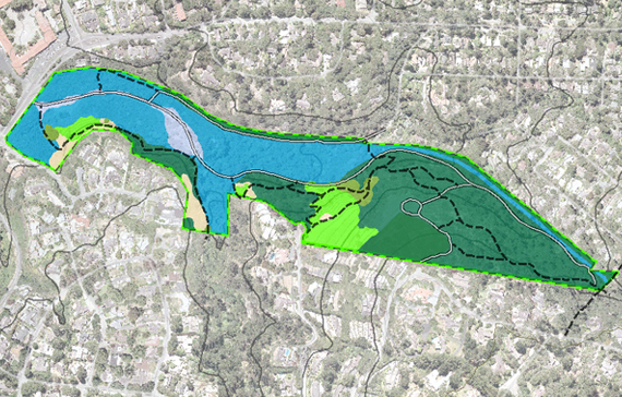
MPRPD, Mission Trails & Palo Corona
Built MPRPD's Natural Resource Management GIS and "LGO on the GO!" mobile app, mapped Mission Trails Nature Preserve, and mapped the 10,000-acre Palo Corona Ranch acquisition.
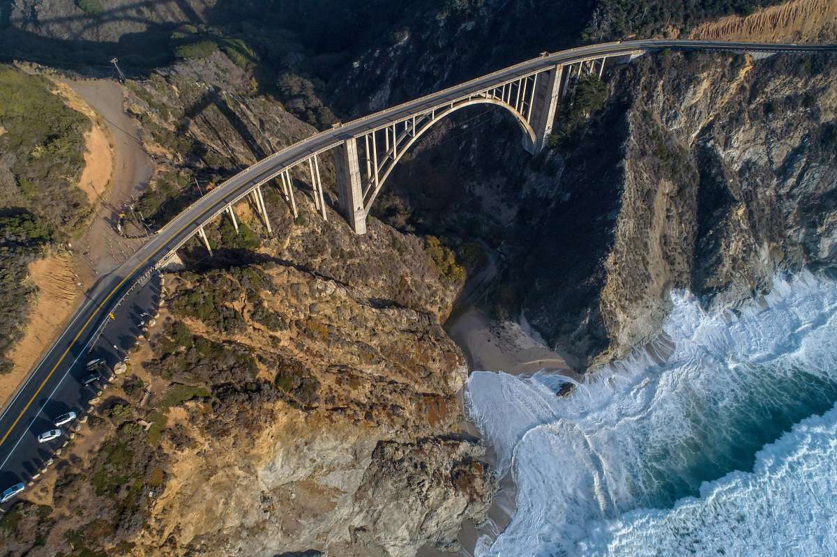
Big Sur Fire, Woodside Fire & MCRCD
Developed pre-fire Web GIS Hubs, created the Monterey County Fire Fuels Mapping Project (FFMP), and mapped Soberanes/Carmel fire lines for 4-tier erosion restoration.
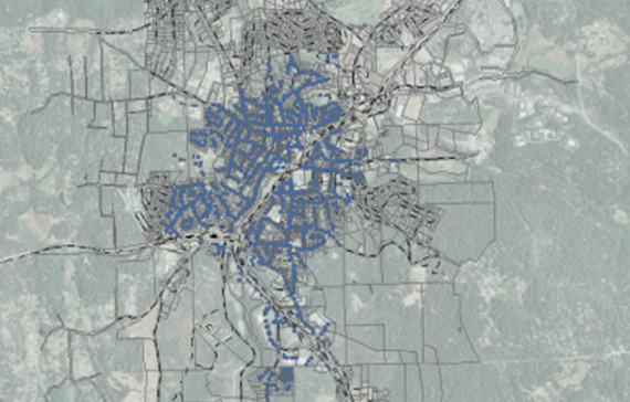
Grass Valley, Covina, MST, LCWA & ClearChannel
Verified utility and transit asset locations, tied in assessor parcel records, and compiled CMMS-ready spatial inventories across California municipalities and agencies.
Latest News, El Niño 2026 & Grant Awards
Live NOAA Emergency Dashboards & 72-Hr Flood Modeling
GID launches custom ESRI Emergency Management Dashboards integrating live stream gauges, real-time traffic, and 72-hour predictive flood mapping for the 2026 El Niño season.
CRSA Steelhead Web GIS Portal & Fire Safe Council Funding
GID successfully secured grant funding for the Carmel River Steelhead Association and the Fire Safe Council of Monterey County to advance watershed and wildfire resilience.
Ongoing GIS & Field Audit Expansions
Continued multi-year GIS support and contract extensions with MPRPD, CAWD, City of Palo Alto, and Rincon.
Connect With #GreenTeam
Our team is ready to discuss how advanced mapping, live spatial analytics, and NGICP green infrastructure can enhance your community's storm mitigation and resilience strategy.
Direct Leadership & Architect Contacts

California Office Locations
Interactive MapsRequest a Consultation or Quote
Inquiry Received!
Thank you for contacting Green Infrastructure Design (#GreenTeam). We will respond to your inquiry shortly.
Monterey & Palos Verdes Estates Locations
Monterey Office
177 Webster Street #368, Monterey, CA 93940
Palos Verdes Estates Office
411 Via Corta, Palos Verdes Estates, CA 90274